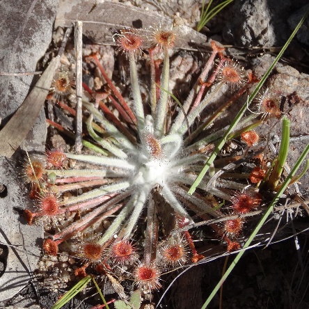
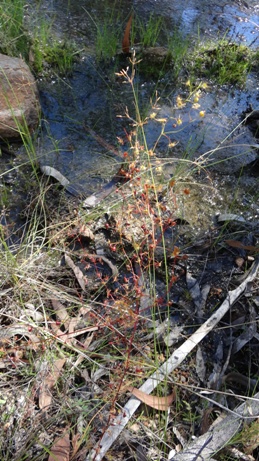
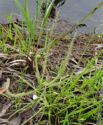
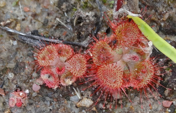
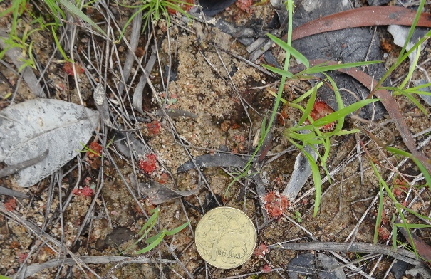
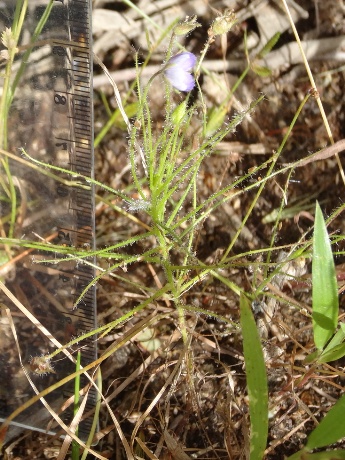
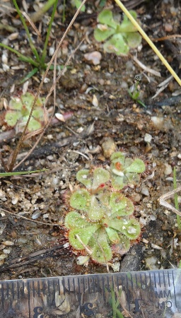
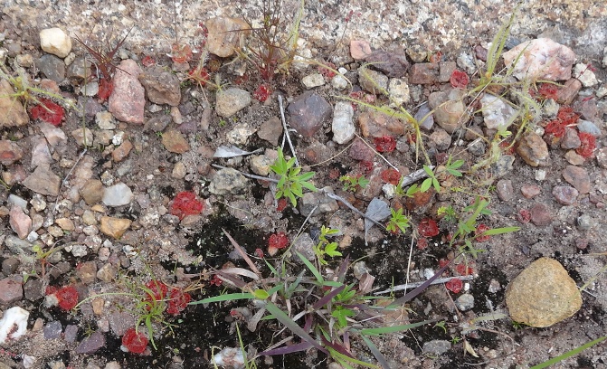
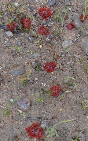
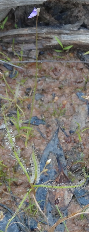
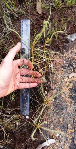
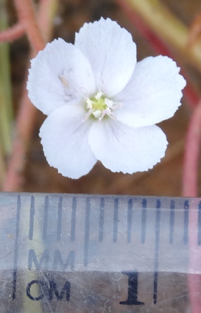
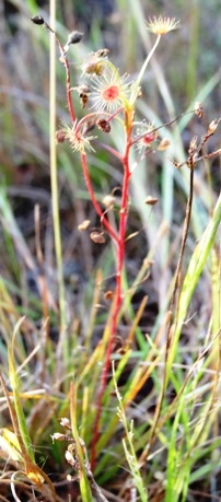
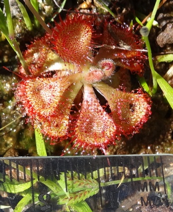
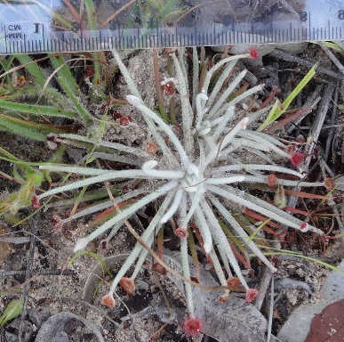
Drosera Lanata
Location: Approx 2km south of Mount Misery near Irvinbank on Top Nettle Rd.
GPS coordinates: 17°29'15.4"S, 145°13'47.4"E
Date of photo: 1-4-13
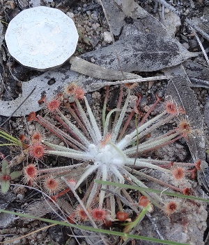
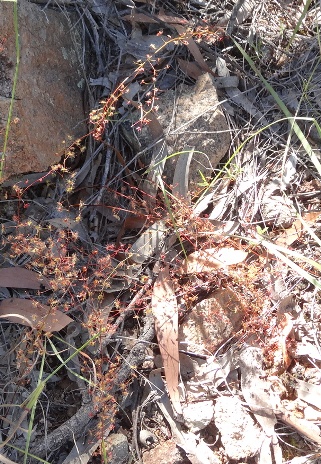
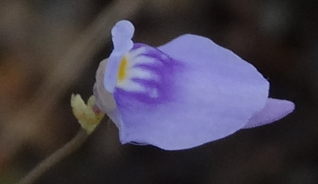
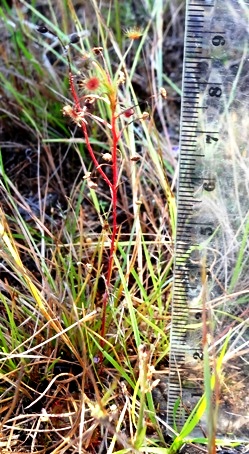
Drosera Lanata
Location: Approx 2km south of Mount Misery near Irvinbank on Top Nettle Rd.
GPS coordinates: 17°29'15.4"S, 145°13'47.4"E
Date of photo: 1-4-13
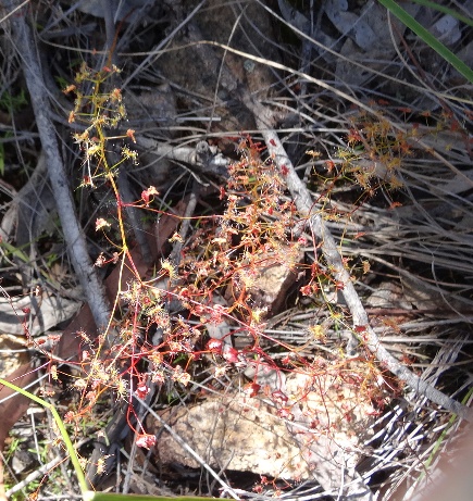
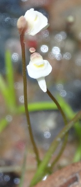
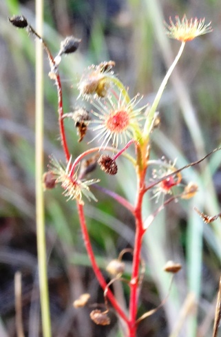
Drosera Lanata
Location: Approx 2km south of Mount Misery near Irvinbank on Top Nettle Rd.
GPS coordinates: 17°29'15.4"S, 145°13'47.4"E
Date of photo: 1-4-13
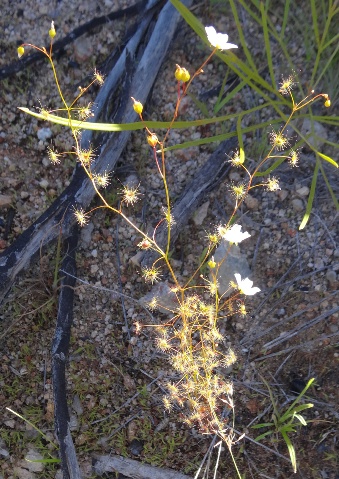
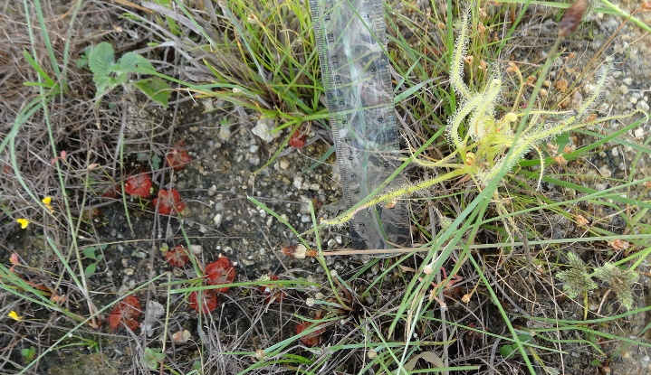
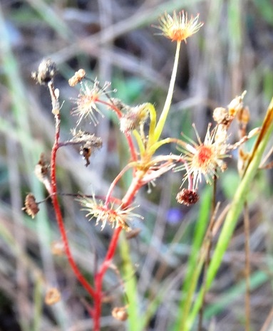
Drosera Lanata
Location: Approx 2km south of Mount Misery near Irvinbank on Top Nettle Rd.
GPS coordinates: 17°29'15.4"S, 145°13'47.4"E
Date of photo: 1-4-13
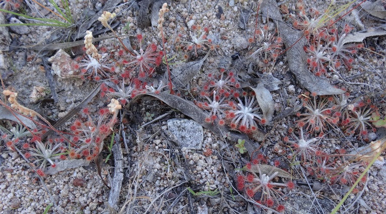
Extent of carnivorous plants SEEN at the above location
Drosera lanata - high
Drosera peltata - low
We saw hundreds of Drosera Lanata that were located above a spring where the ground was dry with some moisture underneath. In the spring below there was boggy soil where some Drosera peltata were growing along with a few Drosera lanata. The terrain was similar to the second location shown below.
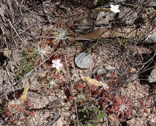
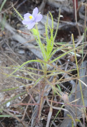
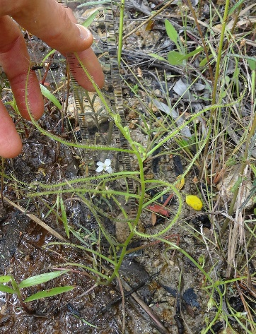
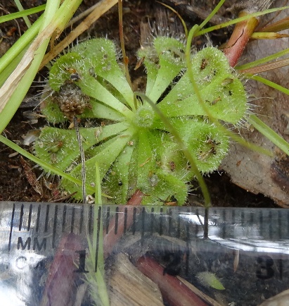
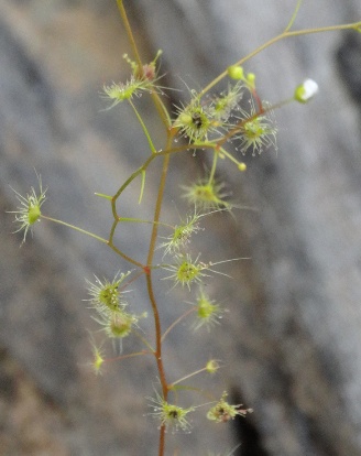
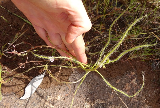
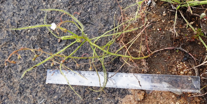
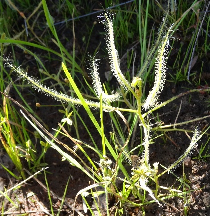
Drosera peltata
Location: Approx 2km south of Mount Misery near Irvinbank on Top Nettle Rd.
GPS coordinates: 17°29'20.0"S, 145°13'45.2"E
Date of photo: 1-4-13
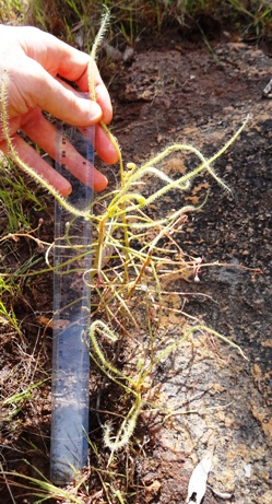
Drosera peltata
Location: Approx 2km south of Mount Misery near Irvinbank on Top Nettle Rd.
GPS coordinates: 17°29'20.0"S, 145°13'45.2"E
Date of photo: 1-4-13
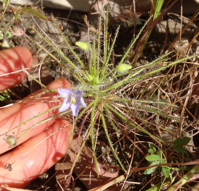
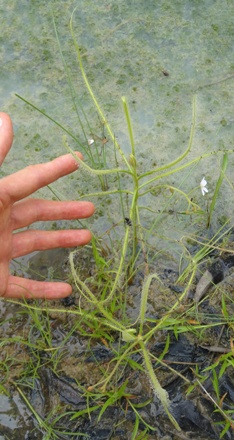
Drosera peltata
Location: Approx 2km south of Mount Misery near Irvinbank on Top Nettle Rd.
GPS coordinates: 17°29'20.0"S, 145°13'45.2"E
Date of photo: 1-4-13
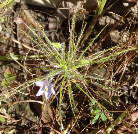
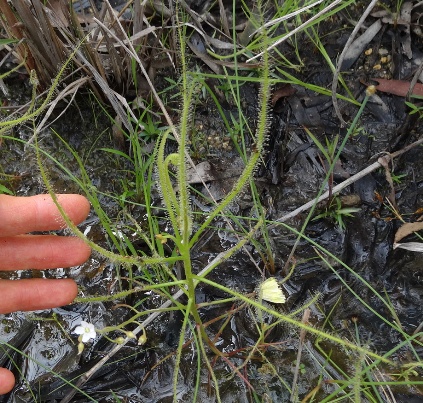
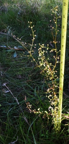
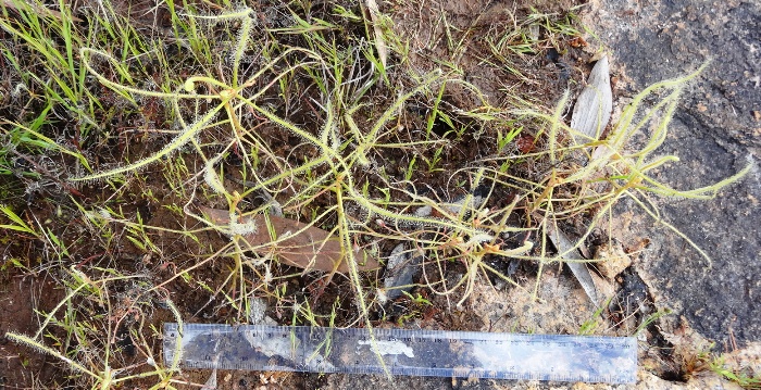
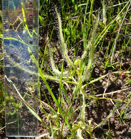
Drosera peltata
Location: Approx 2km south of Mount Misery near Irvinbank on Top Nettle Rd.
GPS coordinates: 17°29'23.4"S, 145°13'43.9"E
Date of photo: 1-4-13
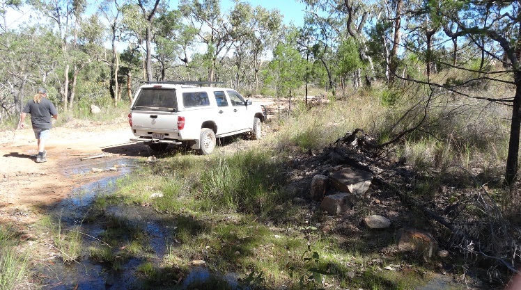
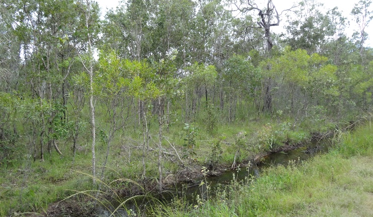
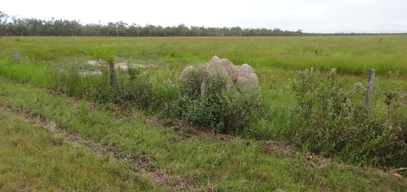
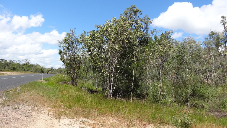
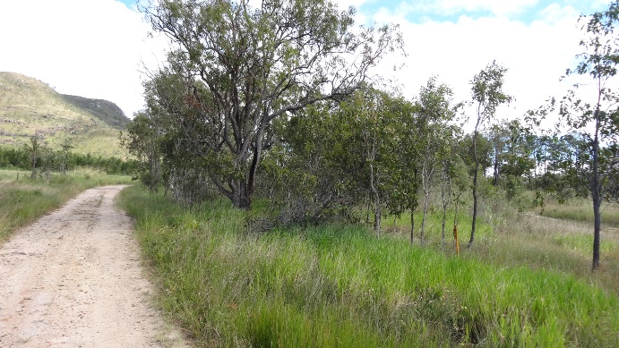
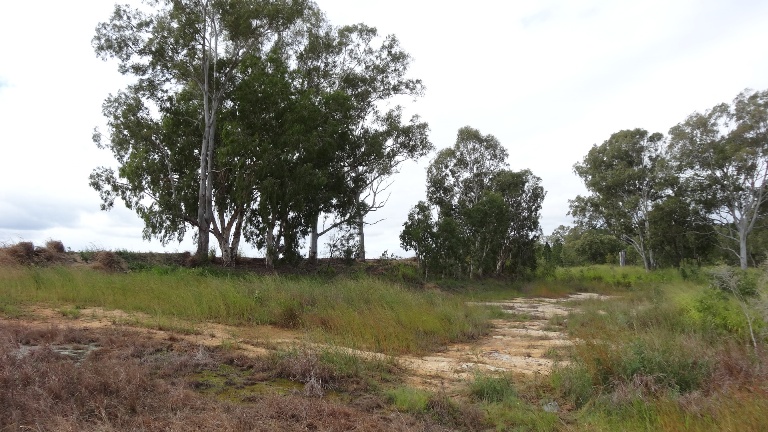
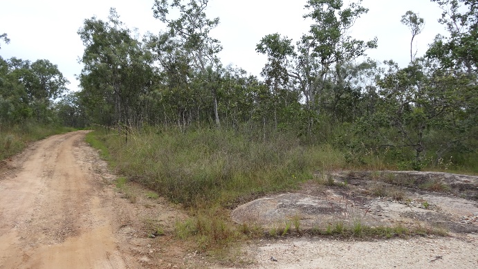
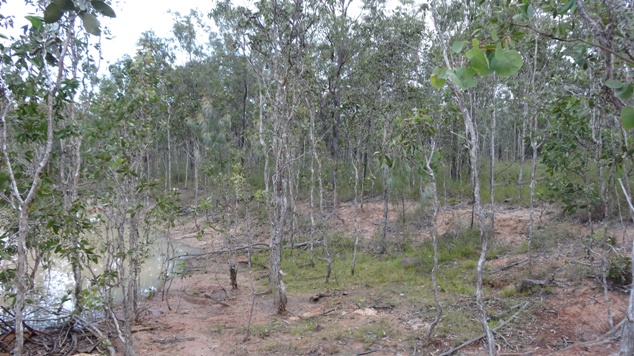
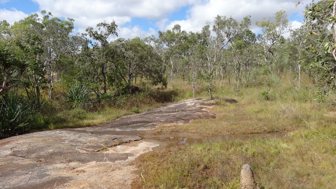
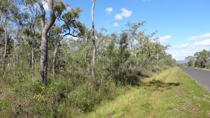
Landscape at second location which is similar to the two nearby ones.
Location: Approx 2km south of Mount Misery near Irvinbank on Top Nettle Rd.
GPS coordinates: 17°29'20.0"S, 145°13'45.2"E
Date of photo: 1-4-13
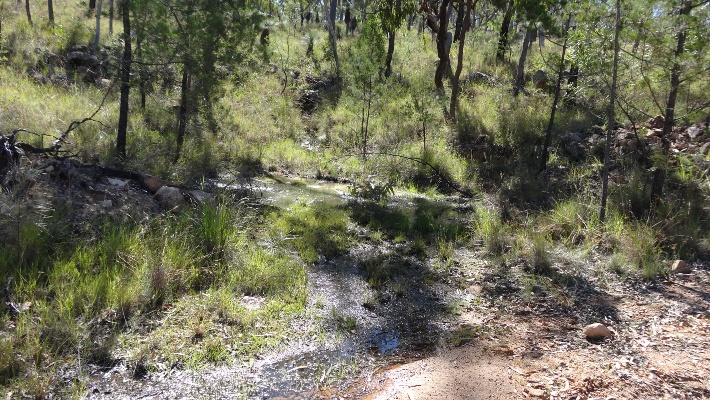
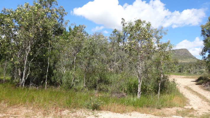
Landscape at second location which is similar to the two nearby ones.
Location: Approx 2km south of Mount Misery near Irvinbank on Top Nettle Rd.
GPS coordinates: 17°29'20.0"S, 145°13'45.2"E
Date of photo: 1-4-13
Some of the Drosera peltata were 40cm tall.
Extent of carnivorous plants SEEN at the above location
Drosera lanata - low
Drosera peltata - high
Mareeba Wetlands Area
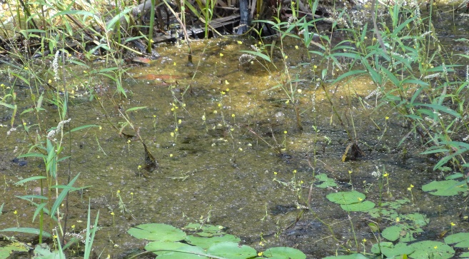
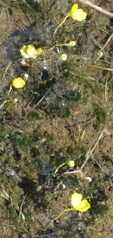
Utricularia Australis
Location: Mareeba wetlands.
GPS coordinates: 16°55'27.9"S, 145°21'37.0"E
Date of photo: 6-4-13
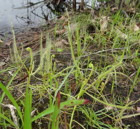
Drosera Indica
Location: Near the road to the Mareeba wetlands.
GPS coordinates: 16°54'52.1"S, 145°22'25.2"E
Date of photo: 6-4-13
Drosera Indica
Location: Near the road to the Mareeba wetlands.
GPS coordinates: 16°54'52.1"S, 145°22'25.2"E
Date of photo: 6-4-13
Drosera Burmannii
Location: Near the road to the Mareeba wetlands.
GPS coordinates: 16°54'52.1"S, 145°22'25.2"E
Date of photo: 6-4-13
Drosera Burmannii
Location: Near the road to the Mareeba wetlands.
GPS coordinates: 16°54'52.1"S, 145°22'25.2"E
Date of photo: 6-4-13
Landscape at location
Location: Near the road to the Mareeba wetlands. Drosera were found on the far bank of the gutter.
GPS coordinates: 16°54'52.1"S, 145°22'25.2"E
Date of photo: 6-4-13
Landscape at location showing the paddock on the opposite side of the road where more Drosera were found.
Location: Near the road to the Mareeba wetlands.
GPS coordinates: 16°54'52.3"S, 145°22'24.9"E
Date of photo: 6-4-13
Extent of carnivorous plants SEEN at the above location
Drosera burmannii - very high
Drosera indica (white flower) - very high
Springmount Road near Walkamin
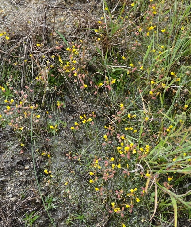
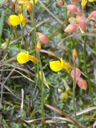
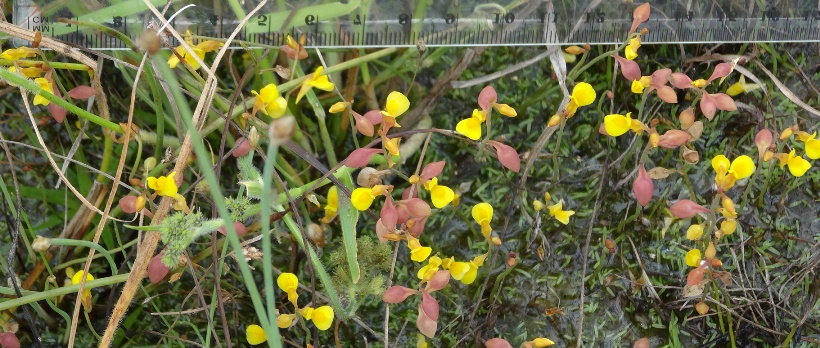
Byblis liniflora
Location: On Springmount Road near Walkamin.
GPS coordinates: 17°07'30.8"S, 145°22'01.5"E
Date of photo: 29-4-13
Byblis liniflora
Location: On Springmount Road near Walkamin.
GPS coordinates: 17°07'30.8"S, 145°22'01.5"E
Date of photo: 29-4-13
Byblis liniflora
Location: On Springmount Road near Walkamin.
GPS coordinates: 17°07'30.8"S, 145°22'01.5"E
Date of photo: 29-4-13
Byblis liniflora
Location: On Springmount Road near Walkamin.
GPS coordinates: 17°07'30.8"S, 145°22'01.5"E
Date of photo: 7-5-13
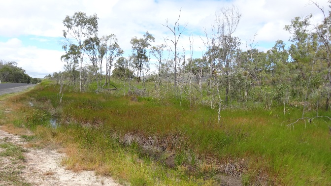
Landscape at location
Location: On Springmount Road near Walkamin. We saw many Byblis and one Drosera indica in the grass.
GPS coordinates: 17°07'30.8"S, 145°22'01.5"E
Date of photo: 29-4-13
Landscape at location
Location: On Springmount Road near Walkamin. We saw many Byblis and one Drosera indica in the grass.
GPS coordinates: 17°07'30.8"S, 145°22'01.5"E
Date of photo: 28-4-13
Extent of carnivorous plants SEEN at the above location
Drosera indica in both white and purple flower forms - low
Byblis liniflora - low
Drosera indica
Location: Near Springmount Road near Walkamin.
GPS coordinates: 17°07'59.3"S, 145°22'47.1"E
Date of photo: 7-5-13
Drosera burmannii among long grass
Location: Near Springmount Road near Walkamin.
GPS coordinates: 17°08'0.3"S, 145°22'46.3"E
Date of photo: 7-5-13
Drosera burmannii among long grass
Location: Near Springmount Road near Walkamin.
GPS coordinates: 17°08'0.3"S, 145°22'46.3"E
Date of photo: 7-5-13
Landscape at location
Location: Near Springmount Road near Walkamin.
GPS coordinates: 17°08'0.3"S, 145°22'46.3"E
Date of photo: 7-5-13
Extent of carnivorous plants SEEN at the above location
Drosera burmanii - high
Drosera indica (white flower) - high
Utricularia gibba
Location: On Springmount Road near Walkamin.
GPS coordinates: 17°07'36.4"S, 145°22'10.3"E
Date of photo: 7-5-13
Landscape at location
Location: On Springmount Road near Walkamin.
GPS coordinates: 17°07'36.4"S, 145°22'10.3"E
Date of photo: 7-5-13
Extent of carnivorous plants SEEN at the above location
Utricularia gibba - medium
Granite Gorge near Walkamin
Utricularia bifida
Location: Farm on western side of Granite Gorge.
GPS coordinates: 17°02'41.2"S, 145°20'41.3"E
Date of photo: 7-5-13
Utricularia bifida
Location: Farm on western side of Granite Gorge.
GPS coordinates: 17°02'41.2"S, 145°20'41.3"E
Date of photo: 7-5-13
Utricularia bifida
Location: Farm on western side of Granite Gorge.
GPS coordinates: 17°02'41.2"S, 145°20'41.3"E
Date of photo: 7-5-13
Drosera burmannii, Drosera indica and Utricularia bifida
Location: Farm on western side of Granite Gorge.
GPS coordinates: 17°02'41.2"S, 145°20'41.3"E
Date of photo: 7-5-13
Drosera indica
Location: Farm on western side of Granite Gorge.
GPS coordinates: 17°02'40.5"S, 145°20'43.0"E
Date of photo: 10-5-13
Drosera indica
Location: Farm on western side of Granite Gorge.
GPS coordinates: 17°02'40.5"S, 145°20'43.0"E
Date of photo: 10-5-13
Landscape at location
Location: Farm on western side of Granite Gorge.
GPS coordinates: 17°02'41.2"S, 145°20'41.3"E
Date of photo: 7-5-13
Extent of carnivorous plants SEEN at the above location
Utricularia bifida - high
Drosera burmanii - medium to low
Drosera indica (white flower) - high and very large
Drosera burmannii and Drosera indica
Location: Eastern side of Granite Gorge.
GPS coordinates: 17°02'50.0"S, 145°21'10.9"E
Date of photo: 10-5-13
Drosera burmannii
Location: Eastern side of Granite Gorge.
GPS coordinates: 17°02'50.0"S, 145°21'10.9"E
Date of photo: 10-5-13
Landscape at location
Location: Eastern side of Granite Gorge.
GPS coordinates: 17°02'50.0"S, 145°21'10.9"E
Date of photo: 10-5-13
Extent of carnivorous plants SEEN at the above location
Drosera burmannii - high
Drosera indica - high
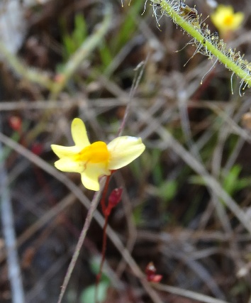
Drosera Peltata? (variation)
Location: Eastern side of Granite Gorge.
GPS coordinates: 17°02'49.6"S, 145°21'8.2"E
Date of photo: 10-5-13
Utricularia caerulea and Drosera indica
Location: Eastern side of Granite Gorge.
GPS coordinates: 17°02'49.6"S, 145°21'8.2"E
Date of photo: 10-5-13
Utricularia caerulea flower about 5mm long.
Location: Eastern side of Granite Gorge.
GPS coordinates: 17°02'49.6"S, 145°21'8.2"E
Date of photo: 15-6-13
Utricularia
Location: Eastern side of Granite Gorge.
GPS coordinates: 17°02'49.6"S, 145°21'8.2"E
Date of photo: 10-5-13
Drosera peltata. 55 cm long.
Location: Eastern side of Granite Gorge.
GPS coordinates: 17°02'49.6"S, 145°21'10.0"E
Date of photo: 16-6-13
Landscape at location
Location: Eastern side of Granite Gorge.
GPS coordinates: 17°02'49.6"S, 145°21'8.2"E
Date of photo: 10-5-13
Extent of carnivorous plants SEEN at the above location
Utriucularia (white flower) - low
Utricularia caerulea - low
Drosera burmannii - medium
Drosera indica - high
Drosera peltata - low
byblis liniflora - very low
Note: This location is only about 100 meters away from the previous one.
Drosera indica.
Location: Eastern side of Granite Gorge.
GPS coordinates: 17°02'42.8"S, 145°21'16.3"E
Date of photo: 4-6-13
Drosera indica.
Location: Eastern side of Granite Gorge.
GPS coordinates: 17°02'47.2"S, 145°21'10.7"E
Date of photo: 4-6-13
 |
 |
Drosera indica.
Location: Eastern side of Granite Gorge.
GPS coordinates: 17°02'47.1"S, 145°21'10.9"E
Date of photo: 4-6-13
Drosera indica.
Location: Eastern side of Granite Gorge.
GPS coordinates: 17°02'47.1"S, 145°21'10.9"E
Date of photo: 4-6-13
Drosera indica.
Location: Eastern side of Granite Gorge.
GPS coordinates: 17°02'47.3"S, 145°21'10.9"E
Date of photo: 4-6-13
Utricularia chrysantha.
Location: Eastern side of Granite Gorge.
GPS coordinates: 17°02'47.4"S, 145°21'11.1"E
Date of photo: 4-6-13
 |
 |
Location: Eastern side of Granite Gorge.
GPS coordinates: 17°02'47.4"S, 145°21'11.1"E
Date of photo: 16-6-13
 |
 |
Location: Eastern side of Granite Gorge.
GPS coordinates: 17°02'47.4"S, 145°21'11.1"E
Date of photo: 16-6-13
Landscape at location.
Location: Eastern side of Granite Gorge.
GPS coordinates: 17°02'47.2"S, 145°21'10.7"E
Date of photo: 4-6-13
Extent of carnivorous plants SEEN at the above location
Utriucularia chrysantha - low
Drosera burmannii - high
Drosera indica (white and purple flower) - high
byblis liniflora - very low
Drosera banksii - very low
Note: This location is only about 200 meters away from the previous one.
Worfram Camp Area
Drosera Indica
Location: On the road to Wolfram Camp.
GPS coordinates: 17°08'28.9"S, 145°03'56.8"E
Date of photo: 28-4-13
Drosera Indica
Location: On the road to Wolfram Camp.
GPS coordinates: 17°08'28.9"S, 145°03'56.8"E
Date of photo: 28-4-13
Drosera burmannii
Location: On the road to Wolfram Camp.
GPS coordinates: 17°08'28.9"S, 145°03'56.8"E
Date of photo: 28-4-13
Drosera Lanata
Location: On the road to Wolfram Camp.
GPS coordinates: 17°08'28.9"S, 145°03'56.8"E
Date of photo: 28-4-13
Landscape at location
Location: On the road to Wolfram Camp. Plants were seen in the gutter on the right of the picture.
GPS coordinates: 17°08'28.9"S, 145°03'56.8"E
Date of photo: 28-4-13
Extent of carnivorous plants SEEN at the above location
Drosera burmannii - high
Drosera indica - high
Drosera lanata - low
Wanted
People are needed to sell and promote the plants. They do not need to
buy them outright. I can freely send them some plants and they can then
pay me as they sell. I am happy to negotioate commission.
![]() Please
make sure you have seen the
main page.
Please
make sure you have seen the
main page.
|
|